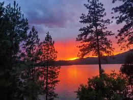
Fiery orange sunset over Shasta Lake silhouetted by pine trees in Northern California

A guide to the four arms

Exploring Shasta Lake

Four arms, 365 miles of shoreline and a century of gold-rush, railroad and fish-hatchery history hidden beneath the water.

One lake, four very different worlds

Shasta Lake is shaped like a giant four-fingered hand — the Sacramento, McCloud, Squaw Creek and Pit River arms — each with its own personality, history and hidden corners. Some you'll share with weekend boaters; others you can have all to yourself.

This guide walks you through every arm: where to stake the houseboat, which trails to hike, what the fish are biting on, and the surprising stories that lie beneath 30,000 acres of clear water.

Use the chips above to jump to an arm, or scroll through the whole lake in one go.
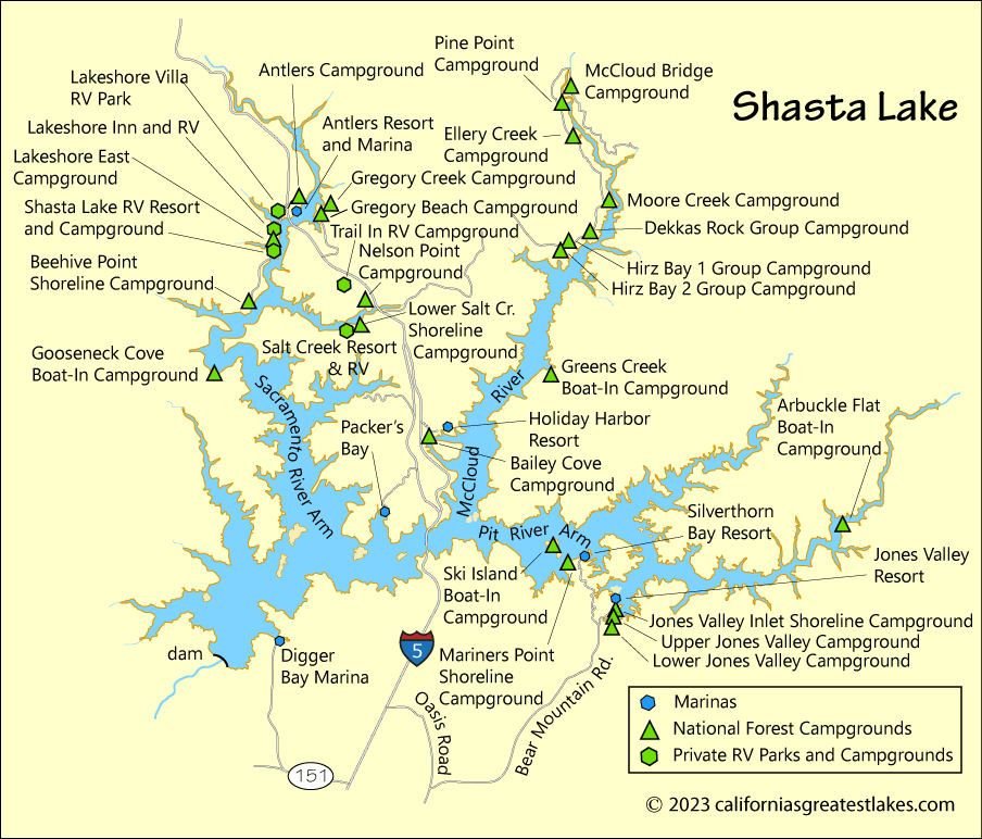
Map of Shasta Lake showing the Sacramento, McCloud, Squaw Creek and Pit River arms with marinas and campgrounds
Shasta Lake — marinas and campgrounds across all four arms.

Arm 1 of 4

The Sacramento Arm

The busiest and most developed arm of Shasta Lake — home to the historic Oregon Trail and the Central Pacific Railroad, both now submerged beneath the surface.

Historic black and white photograph of Kennett California gold rush mining town in the early 1900s
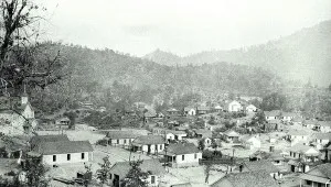
Kennett, CA — once one of the largest mining towns of the 1850s, now under 400 ft of water.

Kennett, CA — a town beneath the water

Founded during the gold rush of the 1850s, Kennett lies directly north of Shasta Dam under about 400 feet of water. It was home to five copper smelters whose sulfur fumes destroyed nearly all surrounding vegetation. Millions of trees were later planted to restore the landscape — a scenic cruise up Big Backbone Creek shows off those rehabilitation efforts beautifully.

Slaughterhouse Island

Named after the Endicott Slaughterhouse and Meat Market that once sat in the saddle between Slaughterhouse and Thunderbolt islands, this spot at the mouth of the Sacramento Arm is now a favorite with college students on spring break. Old boat-in campsites are gone, and no facilities remain on the island today.

Basalt columns at the Goosenecks

North of the Goosenecks, the west shoreline turns rusty-red: basalt rock, formed from lava that cooled quickly near the surface, stained by the iron in the surrounding ground. Near Antlers Resort the basalt has crystallized into crude "fence post" columns — a smaller cousin of Devils Postpile.

Gooseneck Cove Boat-In

Sites:
8 sites · picnic tables, fire grills
Amenities:
Outhouse toilets · no drinking water · pack it in, pack it out
Fee:
Free

Tucked deep in the cove on the west side of the Sacramento Arm — well hidden from the main lake.

Lakehead & the Gregory House

At the end of the Sacramento Arm you'll find Lakehead / Lakeshore, Gregory Creek, Antlers Resort and Indian Creek. In the early 1900s the Gregory home served meals for 25 cents and all-you-can-eat plus a bed for 50 cents. Roy Rogers, Rex Beach and Renny Renfro all stayed here, and Martha Gregory operated the first telephone switchboard between Redding and Dunsmuir. The ranch was flooded when the dam came online in 1945; today Riverview is a day-use area with one of the few remaining sandy beaches on the lake.

Arm 2 of 4

The McCloud Arm

Named for the McCloud River — originally the “McLeod,” after Scottish fur trapper Alexander Roderick McLeod, who was snowbound on its banks in the winter of 1829.

Baird Fish Hatchery — the first on the West Coast

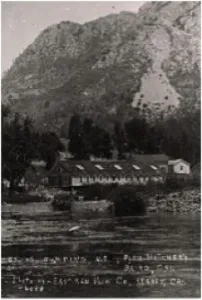
In 1872 Livingston Stone established the first West Coast salmon hatchery where the Pit and McCloud rivers meet, naming it after Spencer Fullerton Baird. Over its decades of operation more than 50 million eyed salmon eggs were shipped worldwide, even seeding salmon runs in New Zealand. The hatchery now lies under hundreds of feet of water — ironic for the place that launched the largest hatchery complex in the world.

Seven years later Stone built a trout hatchery upstream at Green's Creek; most rainbow trout fished today descend from that original McCloud River stock.

Historic photograph of the Baird Fish Hatchery on the McCloud River — the first federal fish hatchery on the West Coast
Baird Fish Hatchery — the first West Coast salmon hatchery, now submerged.

The Grey Rocks

Towering grey limestone walls formed from ocean sediments laid down 200–300 million years ago. Tie off your boat and spend the day hunting for fossilized coral, snails and clams in the cliffs.

Lake Shasta Caverns

Just past Bailey Cove on the east side, tours run every half hour 9am–3pm Memorial Day through Labor Day. Inside you'll find stalactites, stalagmites and a hand-written 1878 signature from discoverer J.A. Richardson, still visible in carbide on the wall. Don't miss the Sandy Creek Mining Sluice or the Rock Box climbing wall on your way out.

Hiking trails of the McCloud Arm

Bailey Cove Trail

2.8 miles loop · Easy

Circles a former mountain. Manzanita and knobcone pine on the sunny south face; pine, oak and Douglas fir on the cool north. Hike counter-clockwise. Pets on leash.

Greens Creek Trail

5.85 miles point-to-point · Strenuous

Boat-in only. Climbs 1,230 ft to a ridge of limestone separating the McCloud and Squaw arms, then descends to Bear Cove. Best in spring and fall — bring water.

Hirz Bay Trail

1.6 miles point-to-point · Easy

Hikers only. From the Hirz Bay amphitheater to Dekkas Rock Campground. Have non-hikers meet you at the Dekkas picnic area for lunch.

Samwel Cave — the Cave of the Lost Maiden

Two miles south of the McCloud Bridge at Point McCloud, a one-mile trail leads up to a cave the Wintu called Sa-Wal — Grizzly Bear Cave — and revered as a holy place. Legend says three maidens went to bathe in its pool for strength; one fell to her death.

"A long time ago, three Indian girls went to an old woman and asked her where they could find good, strong men. She told them to go to the cave and bathe in the pool. There they would find brave men. And so, the three maidens went to the cave, but in the darkness, one of them fell to her death."

In the early 1900s UC Berkeley anthropologists found a young woman's skeleton 70 ft down in Furlong's Room, alongside Ice Age fossils whose preservation rivals the La Brea Tar Pits. Putnam Hall is open to the public; deeper rooms require a permit from the Shasta Lake Visitor Center.

Where to camp on the McCloud Arm

Greens Creek Boat-In

9 boat-in sites at the foot of limestone formations. Picnic tables, bear lockers, fire grills, outhouse toilets — bring your own water. Free. A great base camp for hikers.

Ski Island Boat-In

3-acre island east of Silverthorn with 23 boat-in sites. Picnic tables, fire grills, outhouse toilets — no drinking water. Free. Rent a fishing or patio boat from Silverthorn and make a weekend of it.

Arm 3 of 4

The Squaw Creek Arm

Squaw Creek begins on Mount Shasta in a series of natural springs and winds down through Squaw Valley before flowing into the lake. Flat shorelines and quiet fingers make it a houseboater favorite.

Boaters and houseboats cruising the calm waters of the Squaw Creek Arm of Shasta Lake
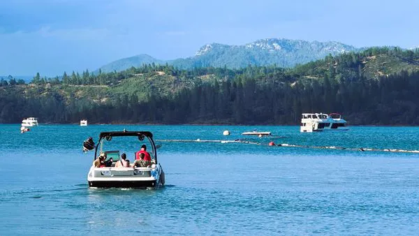
Quiet coves and flat shorelines on the Squaw Creek Arm.

Wildlife and easy staking

The first few miles are some of the flattest shoreline on Shasta Lake — perfect for staking a houseboat or pitching a tent at one of the scattered undeveloped campsites. Keep an eye out for eagles, osprey, otters, the occasional bear and even Rocky Mountain elk. Closed shorelines protect critical habitat — please respect them.

Bully Hill Mine

Gold was discovered on Squaw Creek in 1853; a year later a silver and copper mining settlement followed. In 1901 the Bully Hill Copper Mining & Smelter Company built a giant smelter processing 150 tons of ore a day — expanded to 400 tons by 1907, producing 2-foot copper ingots. Ore was even shipped in on an 8.5-mile aerial tramway from the Afterthought Mine in Ingot.

Lawsuits over toxic fumes shut the smelter in 1910. Today, old rustic gates mark the entrance — inside you'll still find a stone hydroelectric powerhouse, a winery, hard milling stones from Sweden, the blast furnace foundations and piles of burnt slag.

Arm 4 of 4

The Pit River Arm

The largest river in Northern California — and considered by many to hold the best bass fishing on Shasta Lake. The Atsuegewi and Ajumawi dug large pits along the river to trap game; that's where the name comes from.

Double rainbow over Silverthorn Resort marina on the Pit River Arm of Shasta Lake after a storm
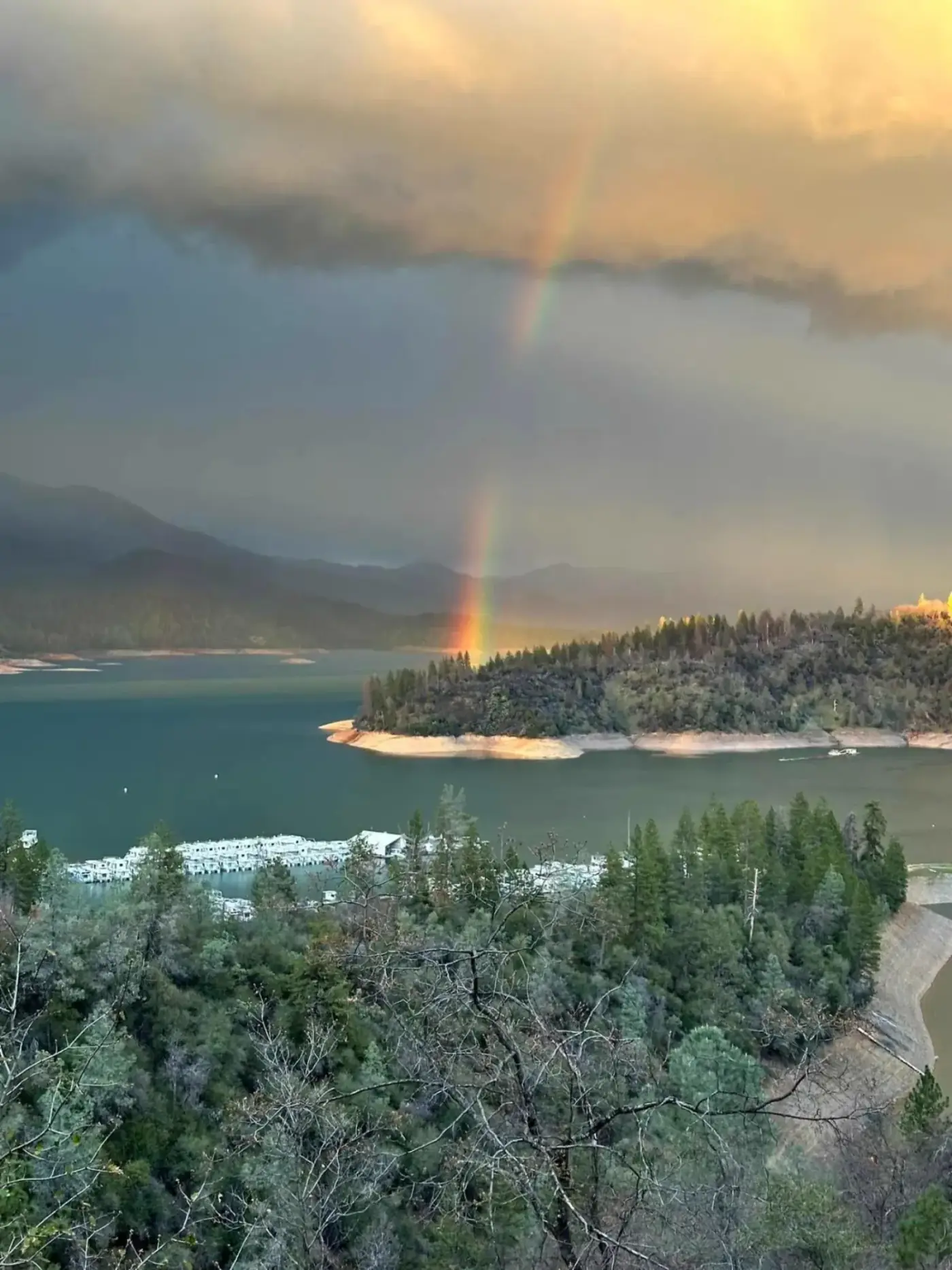
Silverthorn Resort sits on the Pit River Arm.

The outback of Shasta Lake

Past Jones Valley Inlet there are no services — which is exactly why houseboaters love it. Countless coves and forested fingers hide secluded campsites; eagles, osprey, otters, deer and bear are all regular sights along the shoreline.

Clikapudi Trail

An 8-mile loop accessible from three trailheads at Jones Valley Marina — great for mountain biking, horseback riding, running and hiking. The name comes from the Wintu Klukupuda — "to kill" — referring to an 1800s battle between Wintu and local traders. Expect mixed conifer, black oak, small meadows and breathtaking lake views. Bring plenty of water; there's none on the trail and summer temps are punishing — hike mornings or evenings.

Arbuckle Flat Boat-In

Sites:
11 sites · picnic tables, fire grills
Amenities:
Outhouse toilets · no drinking water · pack it in, pack it out
Fee:
Free

~5 miles up the Pit Arm from Jones Valley Inlet, set back in a deep cove on the south side. Carry your gear up the hill.

Waterfalls & dead snags

The upper Pit Arm was never cleared of trees — WWII pulled the crews away — so dead snags fill the water (great for fish, hazardous for boats). Past Arbuckle Flat, water-skiing is prohibited. Look for Bear Creek Falls off the south shore and the bigger Potem Falls on Potem Creek near Fenders Flat.

Plan your Shasta Lake adventure

Whether you're chasing bass on the Pit, hunting fossils in the Grey Rocks or staking your houseboat in a Squaw Creek cove — Silverthorn Resort is your launching point.